Your Jurisdiction on One Map
Command Established puts your entire district on an interactive map—hydrants, stations, points of interest, and custom markers. Mark access points, hazards, and pre-plan information where they actually are.
Your Jurisdiction on One Map
The Maps module gives you a live, interactive view of your entire district. Fire hydrants, stations, and points of interest are all plotted on the same map so you can see your coverage and pre-plan information at a glance.
Filter layers to show or hide hydrants, stations, and different categories of markers. Zoom into a specific address or zoom out to see your whole response area. The map is always current—linked directly to your department's data.
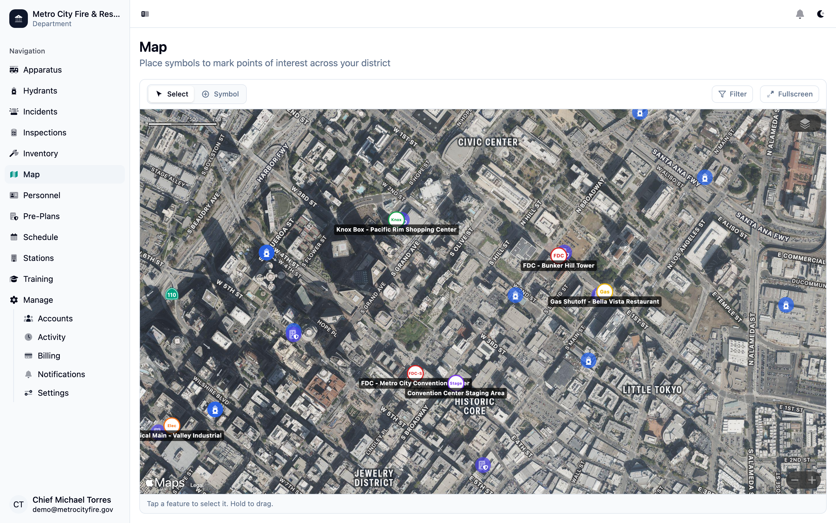
The interactive map with hydrants, stations, and points of interest plotted across your district—filter layers and zoom to any area.
Mark Points of Interest
Place fire symbols directly on the map to mark anything worth noting—access points, knox box locations, FDC connections, hazmat storage, and more. Command Established includes a library of standard fire service symbols so your markers are immediately recognizable.
Each point of interest has a label and notes field. Add critical information about a location—like "gated driveway, code is 4521" or "low bridge on rear access road"—and it's visible to anyone viewing the map. Markers can be dragged to reposition them as conditions change.
Hydrant and Station Integration
Hydrants and stations on the map aren't just pins—they're live links to their full records in Command Established. Click a hydrant marker to jump to its detail page and see flow test history, out-of-service status, and maintenance notes.
When a hydrant is marked out of service or a new one is added to your records, the map reflects the change immediately. Your map data and your operational records stay in sync automatically—no separate updates required.
Note: Interested in pre-incident planning tools? The Maps module is just the start. Command Established includes a full pre-incident planning system—building intelligence, fire protection documentation, hazmat tracking, tactical mapping, and automatic hydrant overlays. Explore Pre-Incident Planning.