
Your Water Supply, Mapped and Maintained
Command Established keeps a complete record of every hydrant in your jurisdiction—location, flow capacity, inspection history, and maintenance status. When you need to know where your water is and how much you can pull, it's all in one place.
Every Hydrant on the Map
See your entire hydrant network on an interactive map. Each hydrant is plotted by location, so crews can find the nearest supply at a glance and pre-incident planning starts with an accurate picture of what's available. Switch to the list view to filter by status, station, or flow class and find any hydrant in seconds.
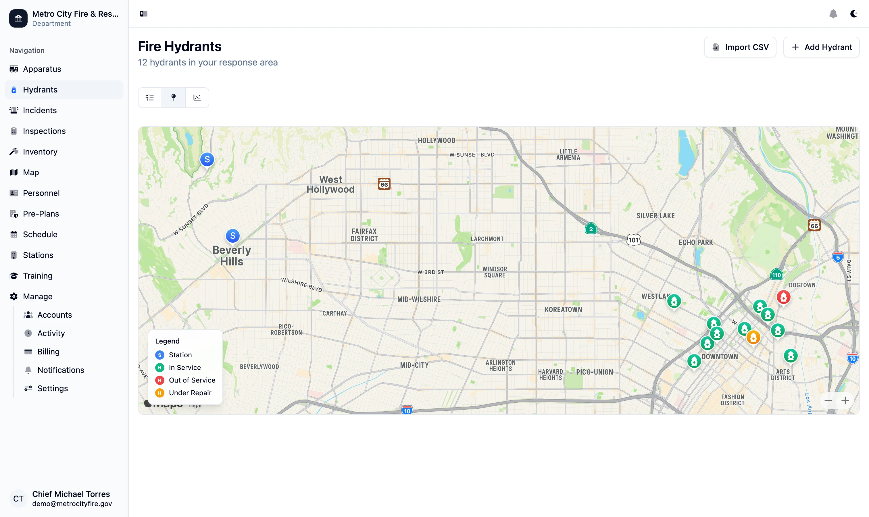
The hydrant map—your entire water supply network, plotted and searchable.
Detailed Records for Every Hydrant
Each hydrant record captures the details that matter on a fireground: location, manufacturer, size, the number and size of outlets, and current operational status. Color-coded classification keeps the available flow obvious so nobody is guessing at the panel.
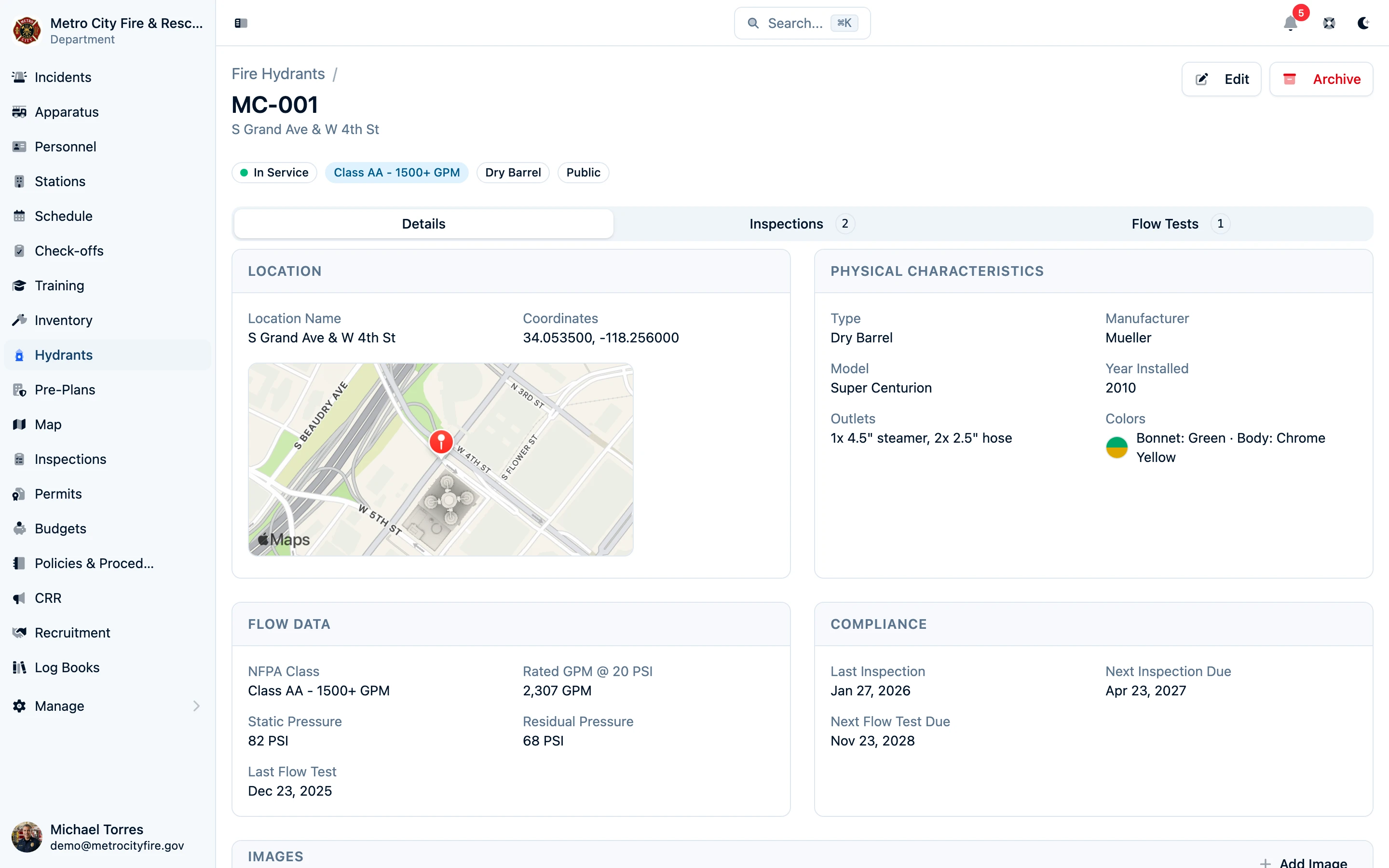
Every hydrant's specs, status, and history in one record.
Log Flow Tests and Inspections
Record flow tests directly against each hydrant—static pressure, residual pressure, and flow rate—building the history you need to classify available water and stay aligned with NFPA 291. Routine inspections are logged the same way, so a hydrant that's out of service or needs maintenance is flagged before it's needed in an emergency.
When it's time for the next test or inspection cycle, the full history is right there on the record—no binders, no separate spreadsheet.
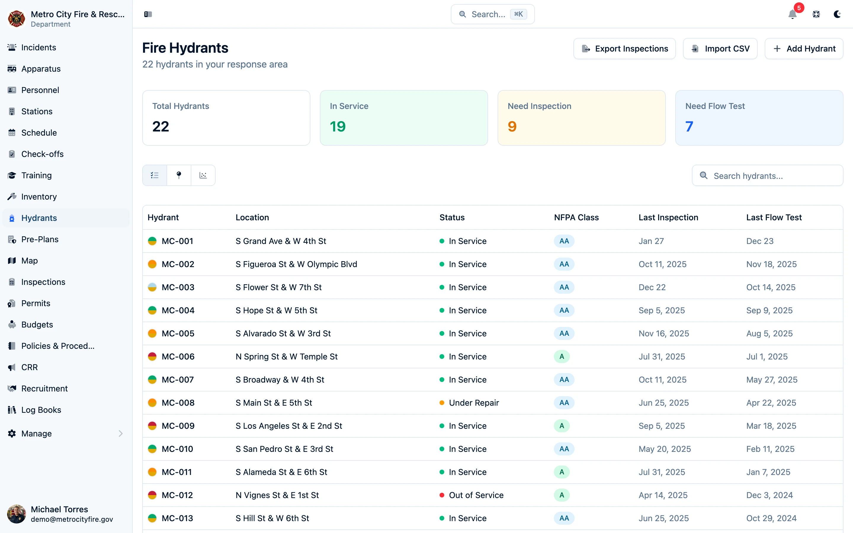
Flow classifications and inspection status across your whole network.
Already have a hydrant inventory? If your hydrants live in a spreadsheet or GIS export, we'll help you import them so your map is populated from day one. Contact us to get started.